


As floodwater spread across Bangkok this week, everyone in the city was asking the same question about the same few streets: the one outside home, the one to school, the one to work. Is it flooded? Can a car get through? Forecasts speak in millimetres, traffic cameras were dark, and the honest answers were scattered across group chats and news feeds.
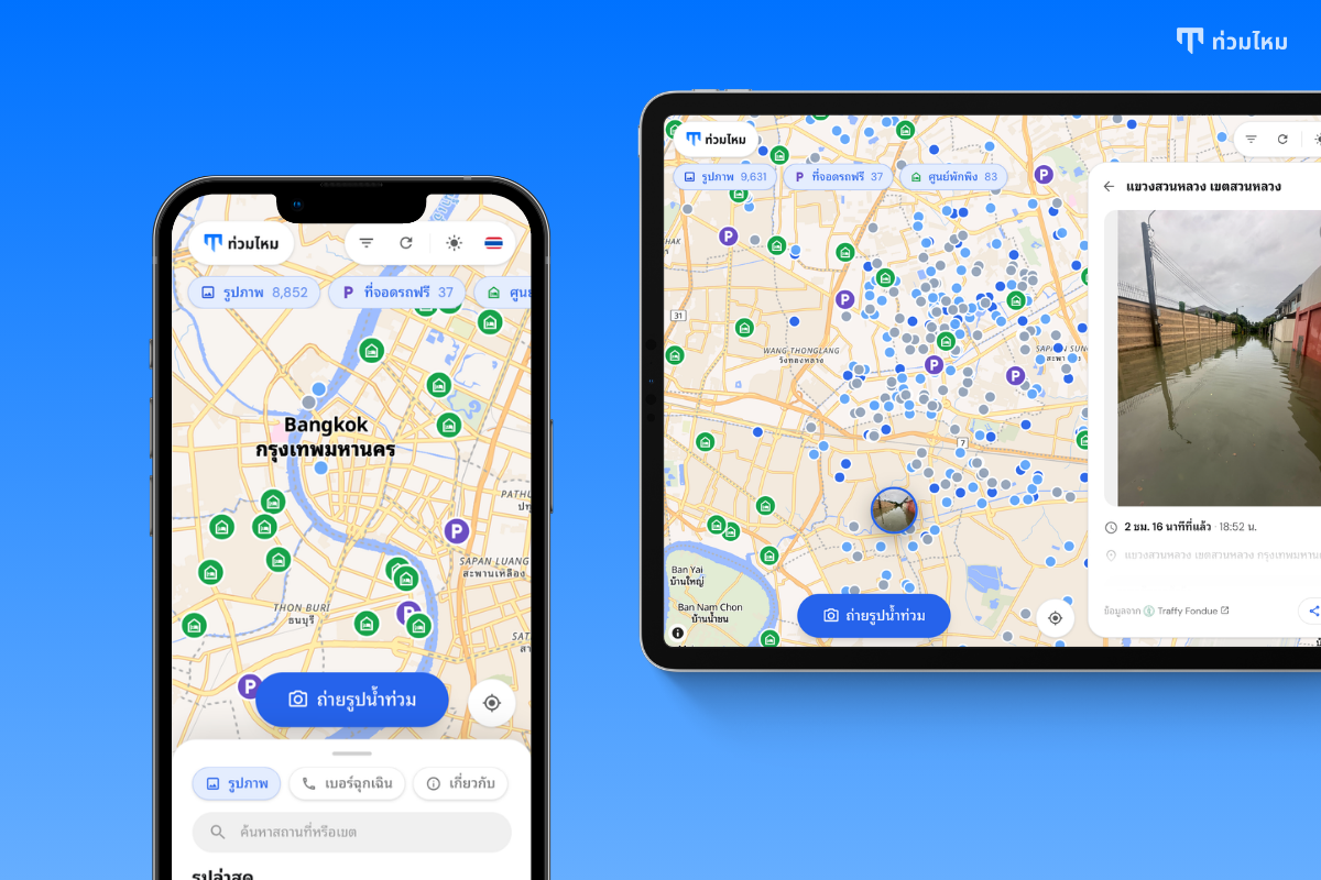
Tuammai went live at tuammai.com on September 27, 2026. Tuammai (ท่วมไหม, Thai for "is it flooded?") is a live map of flood photos for Bangkok and the surrounding area. Open it, find your street, and see what it looks like right now from the latest photo taken there.
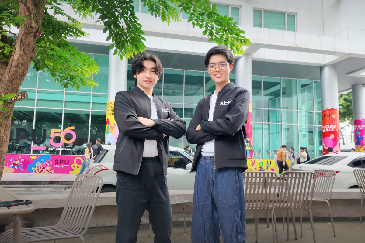
It was built by Phonlawat Sirajindapirom, Co-Founder & CEO of RevisionSuccess.
"I kept refreshing group chats trying to work out whether the road outside my own home was passable, and nothing could tell me. The city already had thousands of photos from people reporting floods through Traffy Fondue, each with a location and a time, sitting in a list nobody could see on a map. So I sat down and built the map. No account, no app to install, just open it and look. If it saves one person from driving into water they cannot see, it was worth it," said Phonlawat Sirajindapirom, Co-Founder & CEO of RevisionSuccess.
 Phonlawat Sirajindapirom, Co-Founder & CEO of RevisionSuccess
See the street, not the forecast
Every flood report that Bangkok residents file through Traffy Fondue, the Bangkok Metropolitan Administration's reporting platform, carries a photo, a GPS position and a timestamp. Tuammai pulls those reports in continuously and puts every photo on the map where it was taken. At the time of writing there are more than 9,000 of them.
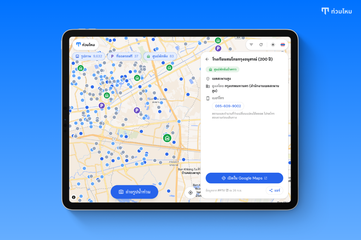
Each dot is coloured by how fresh the photo is: blue for the last hour, lighter blue for one to three hours, grey for anything older, so the loudest signal on the map is what is happening now. Zoom in and the dots become the photos themselves. Tap any one to see the full picture, the exact time, the address and the reporter's note. Filter by district or time range to check the streets on your route, and share a link to any photo or place.
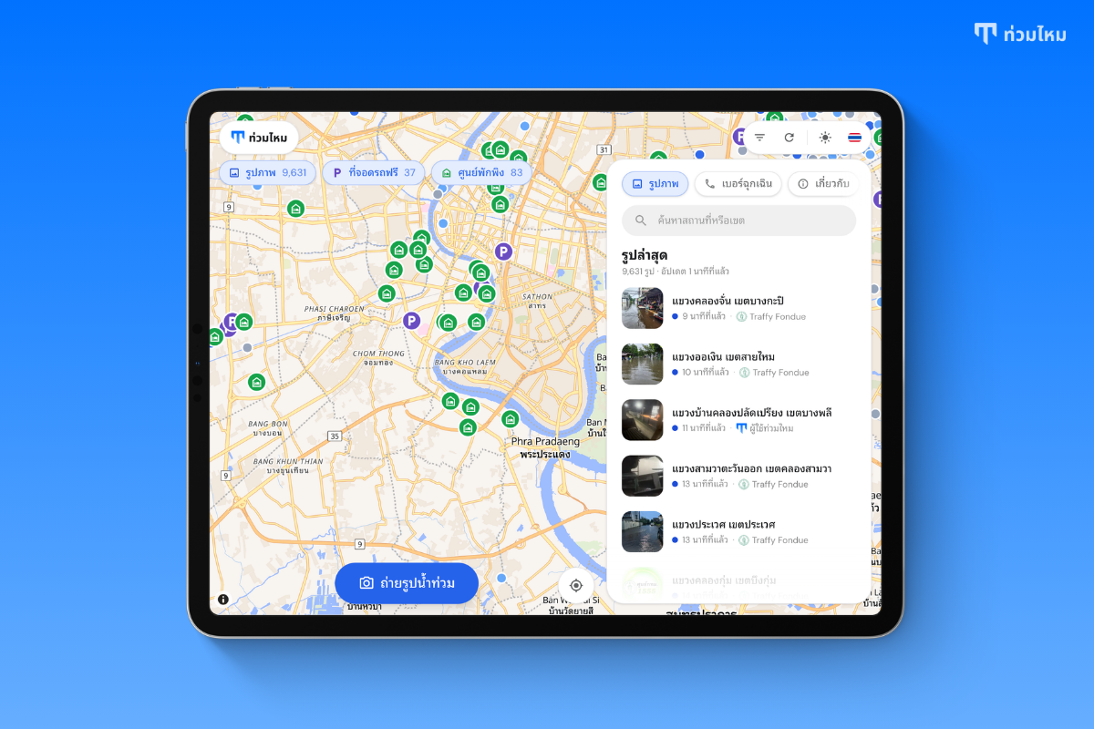 The photo list beside the map: the newest reports first, each with its district, how long ago it was taken and where it came from
Add what you see
If you are standing at a flooded spot, you can add to the map in about twenty seconds. Tap "Take a flood photo", allow location and camera, take the photo with the live camera, answer two questions, how deep the water is and whether cars, motorbikes or people can get through, and submit. It appears on the map for everyone at once.
There is no gallery upload, so every photo was taken where and when it says. There is no account, so there is nothing to sign up for while you are standing in water.
Where to park, where to shelter
Photos tell you what is happening. The relief layer tells you what to do about it. Tuammai also maps the free parking that agencies and malls have opened for people moving cars to high ground, such as Suvarnabhumi Airport's long-term car parks, and the temporary shelters the city has set up, 83 of them at the time of writing. Each place shows what is known about it: capacity, opening times, who runs it, a phone number to call ahead, and a button that opens directions in Google Maps. Every entry cites the announcement it came from.
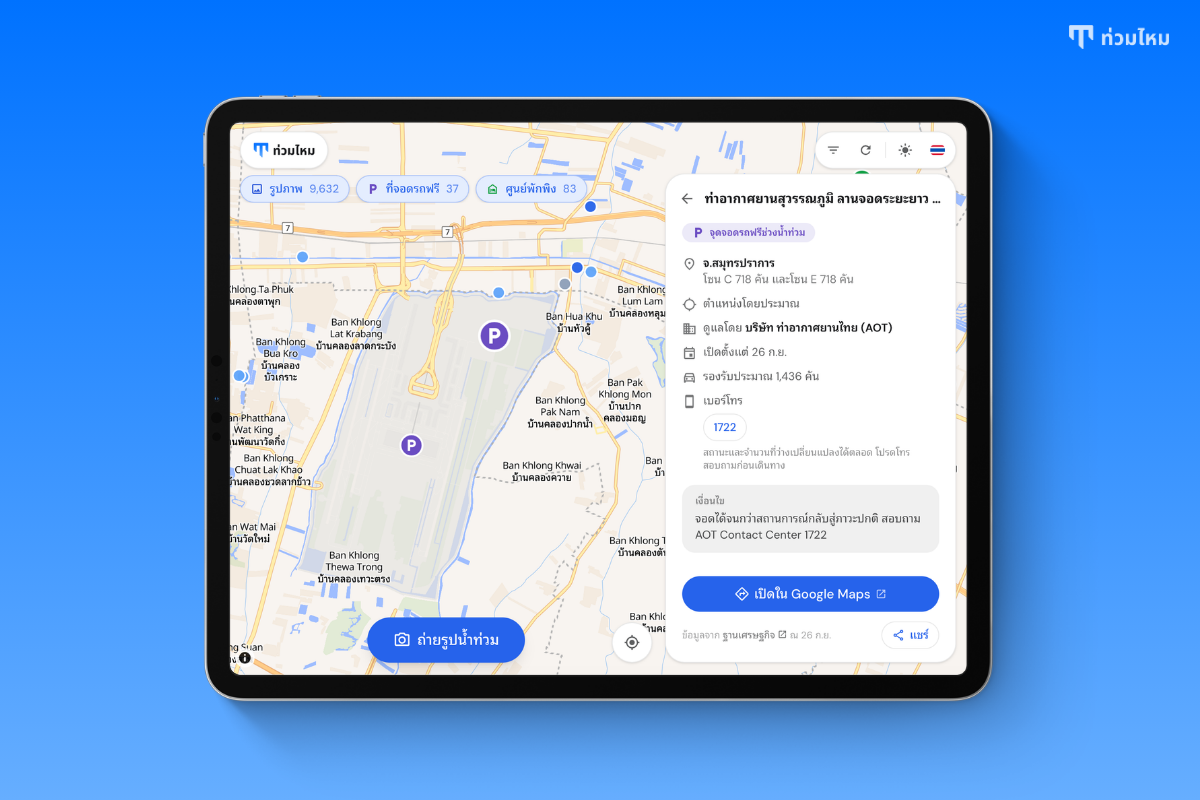 1 / 2A free parking site on Tuammai: Suvarnabhumi Airport long-term car parks, zones C and E, run by Airports of Thailand, with capacity, opening date, phone number and directions
Built for a bad day
Tuammai is a website, not an app to install. It works in Thai and English, in light and dark mode, and it asks for nothing: no account, no tracking, no sign-up. Your location stays on your device unless you choose to submit a photo. An Emergency tab lists the hotlines you may need, from the city's 1555 to the electricity, water and road authorities, each a single tap to call.
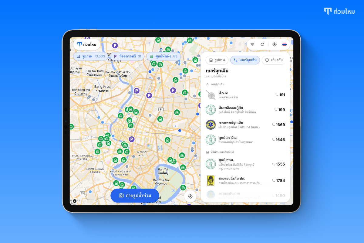 The Emergency tab: police, fire and rescue, medical emergency, the Erawan Center, the city's 1555 hotline and the disaster hotline, each with its agency's seal and one tap to call
One thing Tuammai is not is a reporting channel. To report flooding to the city, use Traffy Fondue or call 1555. In an emergency, call 191, 199 or 1669.
Why an education company built a flood map
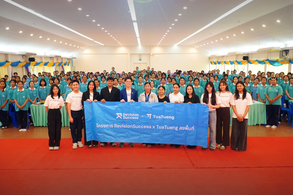
RevisionSuccess builds AI-native learning tools for more than 100,000 students across RevisionSuccess and TuaTueng. Nothing about that says flood maps. But the people who build those tools live in this city, and this week the most useful thing any of us could build was a way to see the water.
Tuammai is free, it credits the Bangkok Metropolitan Administration and Traffy Fondue for the photos and OpenStreetMap for the map, and it will stay up for as long as the water does.
If you are in Bangkok this week, open tuammai.com before you leave the house. And if you find yourself standing in water, take one photo. Someone behind you needs it.